
Geodata is specialised in cartography, Geographic Information Systems (GIS) that assist public managers in decision-making processes towards economic development policies.
Geodata AND THE SDGs
By 2030, enhance inclusive and sustainable urbanization and capacity for participatory, integrated and sustainable human settlement planning and management in all countries.
By 2020, enhance capacity-building support to developing countries, including for least developed countries and small island developing States, to increase significantly the availability of high-quality, timely and reliable data disaggregated by income, gender, age, race, ethnicity, migratory status, disability, geographic location and other characteristics relevant in national contexts.
Fully operationalize the technology bank and science, technology and innovation capacity-building mechanism for least developed countries by 2017 and enhance the use of enabling technology, in particular information and communications technology.
IMPACT FACTS
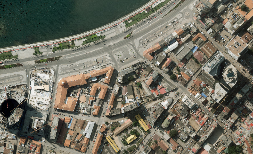
REAL STATE PROPERTY REGULARIZATION AND LEGALIZATION PROGRAM (INTENDED)
- IT technology project to assist Angolan national authorities in the complex process of mapping, registering, documenting and legalizing real estate properties.
- Construction of a national integrated real estate property registry system, combining a legal / registration database and a Geographic Information System database to create a complete record of the properties to be registered.
- Multidisciplinary team of more than 120 specialists such as legal advisors, architects, engineers, geographers, air pilots, surveyors, topographers, GIS specialists and IT specialists
- Estimated registration of 150,000 properties throughout the country: 110,000 in new centralities + 40,000 resulting from confiscation proceedings (20,000 of them in Luanda)
- Legalization of the state's housing patrimony
- Legalization of housing development programs – new centralities
- Document scanning and indexing: total 2.4 million documents from 18 entities until 2016
- Quality Control - LADM
- Covered area by aerial photographic survey: ~3000 Km2 in Luanda + ~2200 Km2 in 38 other cities
- More than 50.000 families allowed to have access to credit by registering property rights
THEORY OF CHANGE
Geodata’s program: Urban Cadastre has as an ultimate goal is the promotion of the legal and organized urban grown and national real estate market with adequate protection of owners’ rights
Geodata - Urban Cadastre
Geodata’s program: Urban Cadastre has as an ultimate goal: the promotion of the legal and organized urban grown and national real estate market with adequate protection of owners’ rights.
Read more below